![]()
Entry Date: 05.12.2018, at 16:00:00 hrs (local)
Whangarei - Whangarei
Ticking Bomb
| PRID: | 11682 |
|---|---|
| LegID: | 315 |
| LegNo: | 64 |
| Latitude: | S035°43.41' |
| Longitude: | E174°19.57' |
| Day#: | 821 |
| Log (Leg): | 15 nm |
| Log (Total): | 47138 nm |
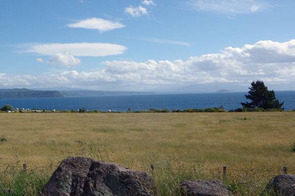
At this time we are not aware that Lake Taupo is actually a crater lake, a so called caldera, of a gigantic super volcano which is located underneath this whole area.
South of the lake we stop at the town Turangi and we visit the Volcanic Activity Center. Here we learn that 26,000 years ago Taupo erupted quite powerful. It was the world´s largest known eruption over the past 70,000 years, ejecting 1170 cubic kilometers of material and causing several hundred square kilometers of surrounding land to collapse and form the caldera. Water filled the caldera later.
The most recent major eruption happened in 232 CE. It is believed it has ejected 100 cubic kilometers of material, of which 30 cubic kilometers had been ejected in a few minutes. This was one of the most violent eruptions in the last 5000 years. The eruption devastated much of the North Island.
An eruption of super volcanoes like Yellowstone in the USA, Toba in Indonesia or Taupo here in New Zealand could mean global catastrophic climate impact and the extinction of many species. Currently it is impossible to predict when any of the super volcanoes will erupt again. But it is not a question “whether” they will erupt again, it is only the question “when”.
New Zealand’s scientists understand the pending danger of the Taupo and other volcanoes very well and constantly monitor seismic activites, changes in the lake bed, water level, temperature and water quality. This provides important information about possible hazards caused by volcanic activity. This makes us feeling much saver.